Last 5 photo published
on this portfolio
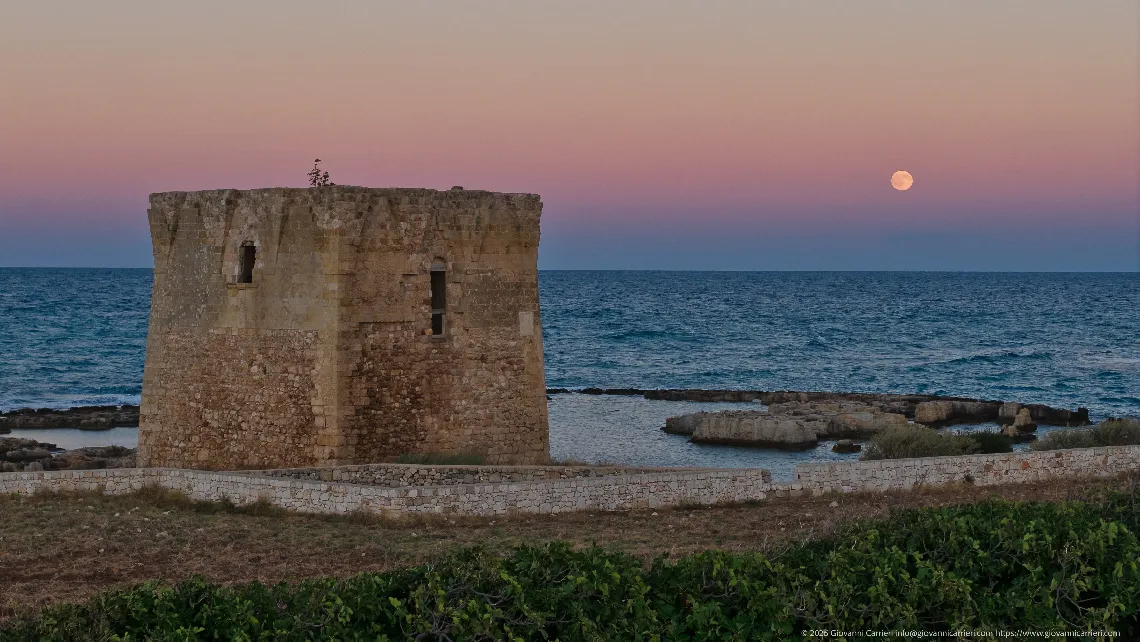
San Vito Tower and the full moon, Polignano a Mare
San Vito Tower stands on the coast north of Polignano a Mare, a short distance from the abbey of the same name. It formed part of the Adriatic coastal defence and watchtower network, helping to protect the abbey from raids by sea. It is also known locally as the “Saracen tower”, a name referring to the raiders it was built to defend the coast against. The tower has a square plan and a compact structure, with only a few openings in its stone walls. Today, a low dry-stone wall marks the boundary of the tower grounds, surrounded by uncultivated land and low scrub. The photograph was taken from a drone flying at low altitude and facing east. The tower stands on the left of the frame, beside a flat rock shelf extending into the sea. As the sun sets, a pink band colours the sky above the horizon while the full moon rises over the Adriatic.
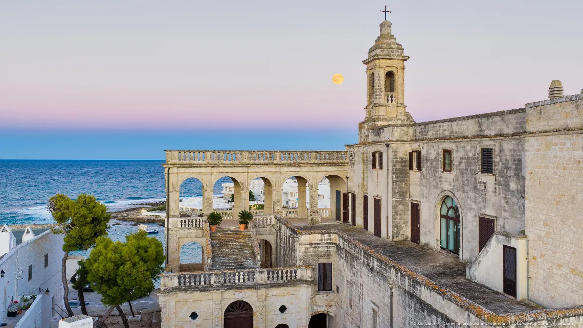
The loggia and bell tower of the Abbey of San Vito, Polignano a Mare
The Abbey of San Vito stands on the coast in the hamlet of the same name, north of Polignano a Mare, overlooking a small landing place. According to tradition, the relics of Saint Vitus arrived on this stretch of coast in the early Middle Ages. The monastery's history includes a medieval Benedictine phase and a later Franciscan presence. In 1866, the abbey was sold into private ownership, while the church remained under separate ownership. On 14 June, the saint's statue is carried by sea in a procession from San Vito to Polignano. The complex retains elements from different periods, including a church of medieval origin, monastic buildings and later additions. The bell tower rises above them, facing the sea and topped by a spire. A flight of steps leads to an arcaded loggia with a balustrade, a distinctive feature of the seaward façade. The loggia and staircase fill the foreground, with the main abbey building and bell tower to the right, and the hamlet's white houses and coastal pines to the left. Shortly after sunset, the full moon appears above the pink band along the eastern horizon.
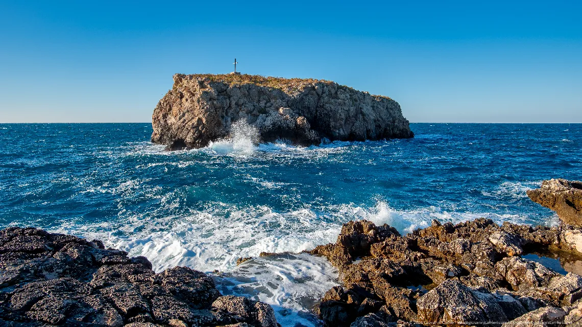
The Hermit's Rock in rough seas, Polignano a Mare
The Hermit's Rock, also known as the island of San Paolo, is a small limestone islet a short distance off the coast of Polignano a Mare, south of the town centre. Its sheer sides rise to a flat top covered in low vegetation and crowned by a cross. Its name is linked to the legend of a hermit who chose the islet as a place to live and meditate. The rock is a nesting site for seabirds and is protected as a Special Protection Area within the Natura 2000 network. The photograph was taken from the rocky shore opposite the islet, close to sea level. In the foreground, dark rocks worn by the water frame the stretch of rough sea between the shore and the islet. A wave breaks against the base of the rock. The late-afternoon light in late September illuminates the side facing the coast beneath a cloudless sky.
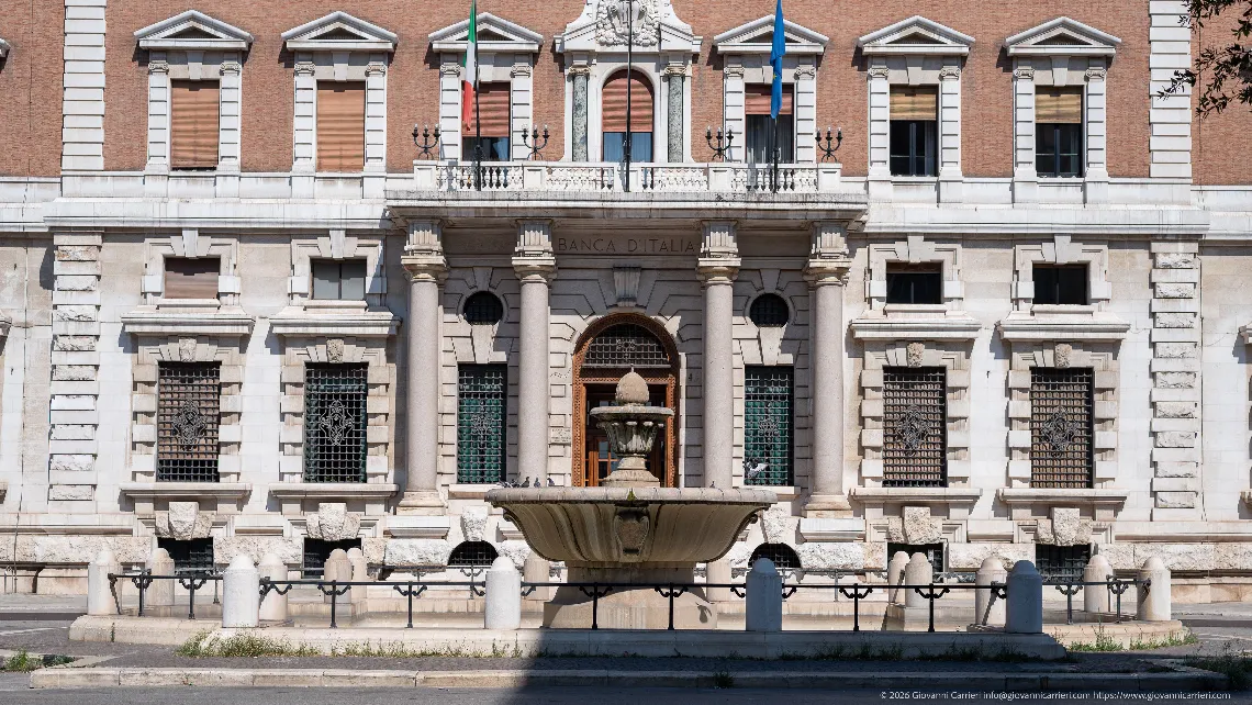
The Bank of Italy Palace and its Fountain
The Bank of Italy building stands at Corso Cavour 4, at the entrance to Bari's Umbertine district, along the stretch between the Chamber of Commerce and the Teatro Petruzzelli. The site was occupied by the sheds of the so-called Iron Market when, in 1926, work began to a design by the engineer Biagio Accolti Gil; construction lasted six years and the building was presented to the city in October 1932, taking in the offices previously housed in via Cairoli. It rises over four levels plus a basement and deliberately adopts a Renaissance and Mannerist language instead of the Fascist-era style then prevailing: rusticated work and white stone define the lower band, while red brick cladding characterises the upper part, articulated by Doric and Ionic orders. The monumental entrance, preceded by a flight of steps, is framed by four columns supporting the ceremonial balcony from which the Italian and European flags fly. The large stone fountain seen in the foreground was built together with the palace and later transferred to the Municipality of Bari; it is still part of the city's ornamental fountain maintenance programme. Building and basin together have become one of the most recognisable images of twentieth-century middle-class Bari.
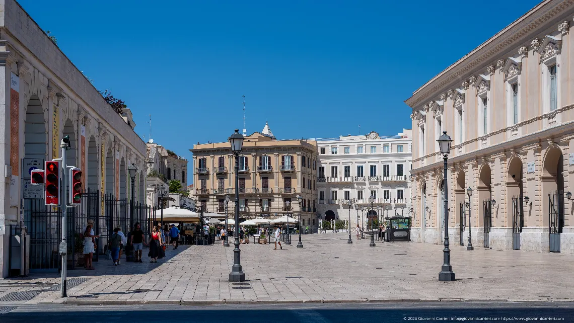
Piazza del Ferrarese and the Spazio Murat
Piazza del Ferrarese is the threshold between the nineteenth-century Murat district and Bari's old town: this frame shows it from Corso Vittorio Emanuele II, with the traffic light and the pedestrian-area sign marking the boundary beyond which the city can only be crossed on foot. The square began as the southern extension of piazza Mercantile and in the seventeenth century was still a small parade ground serving the guard post; at its centre, level with today's strada Vallisa, stood one of the gates in the city walls built under Philip III of Spain, designed to ease the movement of goods towards the market. The foundations of that gate and the original paving stones of the road survive in the excavation left open in the middle of the square. The present name appears in the eighteenth century and historians attribute it either to Girolamo Barucchelli, a native of Ferrara who owned property here, or to the ironsmith Stefano Fabbri, who built the neoclassical arcade. On the left stands the Spazio Murat, the old market building designed by Giuseppe Gimma in 1817, later demolished and rebuilt, and today a venue dedicated to art, architecture and research; the arcaded fronts closing the other sides belong to the former Fish Market, built by Vincenzo Capirri in 1837 and raised to two floors by 1903, and to Palazzo Traversa, built by Francesco De Giglio in 1914. Entirely pedestrian today, the square is the city's drawing room and the heart of its nightlife.